MIAMI — Hurricane Polo exploded into an extremely dangerous Category 5 storm off the southwestern coast of Mexico on Tuesday, capping one of the fastest intensification bursts ever recorded in the eastern Pacific, and is expected to rake the coastline with life-threatening rain and surf while its catastrophic core stays offshore.
The National Hurricane Center said Polo’s maximum sustained winds reached 165 mph (270 km/h) by early Tuesday afternoon, with an estimated minimum central pressure of 920 millibars. The storm was nearly stationary about 215 miles (345 km) south of Zihuatanejo and 350 miles (565 km) south-southeast of Manzanillo, its hurricane-force winds packed into a compact core just 35 miles (55 km) wide.
Forecasters expect a generally west-northwestward drift over the next couple of days, keeping Polo near but off the coast of southwestern Mexico through midweek. Some additional strengthening is likely through tonight, with fluctuations in strength possible Wednesday and Wednesday night.
A record-shattering ramp-up
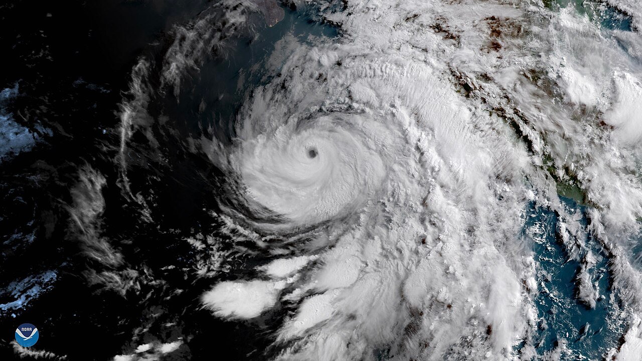
What turned Polo into Tuesday’s trending story was the sheer speed of its intensification. Hurricane specialist Michael Lowry noted the storm was a modest 45-50 mph tropical storm early Monday, then strengthened 110 mph in 24 hours — an extreme rate in the reliable eastern Pacific record matched or exceeded only once, by Hurricane Patricia in 2015. Polo is also the basin’s third Category 5 hurricane this season, tying the 2018, 2002 and 1994 seasons for the most on record. The NHC described a spectacular presentation on satellite imagery, with a small, well-defined eye.
Even with the core remaining at sea, Polo’s outer bands are expected to drop 3 to 6 inches of rain — with isolated totals up to 8 inches — across coastal Guerrero and Michoacán through Thursday, which the NHC warns may produce life-threatening flooding and mudslides, especially in areas of steep terrain. Lesser totals of 2 to 4 inches are possible in coastal Oaxaca, Colima and Jalisco.
A Tropical Storm Warning stretches from Tecpan de Galeana to Punta San Telmo, where tropical-storm conditions are expected by early Wednesday; a Tropical Storm Watch covers the coast west of Punta San Telmo to Playa Perula. Swells from Polo are expected to bring life-threatening surf and rip currents to the southwestern Mexico coast for the next several days.
A NOAA Hurricane Hunter aircraft is en route to investigate the storm, and the NHC cautions that additional watches and warnings may be needed. Interests along Mexico’s entire Pacific coast, including resort towns far from the storm’s center, are advised to keep monitoring the forecast.
Sources
National Hurricane Center — Hurricane Polo Intermediate Advisory 8A
Michael Lowry, WPLG Local 10 — Polo undergoes extreme rapid intensification
National Hurricane Center — nhc.noaa.gov
Featured image: GOES East satellite view of Hurricane Bud off Mexico’s Pacific coast in 2018, shown as an illustrative storm image — NOAA, public domain, via Wikimedia Commons.